 |
 |
 |
 |
 |
| This route is approximately one mile in length and being "circular" can be joined at any point along it. It passes the key buildings facilities of the village including the pub for those requiring a break! Most of the route is along pavements but be aware that there are two short sections of road without a pavement: Old Cannock Road and by the side of the school grounds in Saredon Road. Don't forget to walk on the right hand side facing any on-coming traffic. The route also uses three short footpaths and the church driveway. | 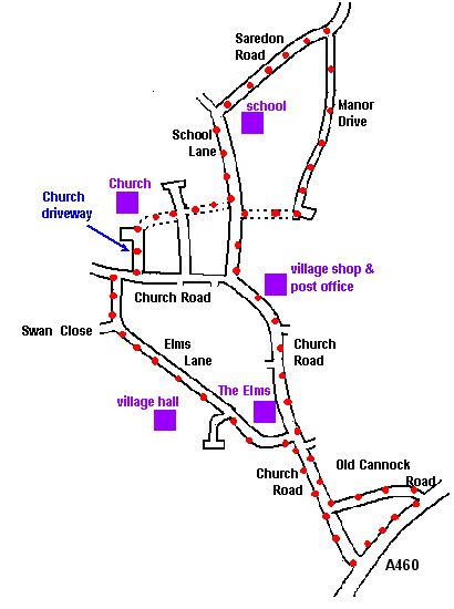 |
|
Downloadable Routes These routes have been planned by John Parton who has numbered each route for convenience only. Designated rights of way are numbered separately by the county council. He advises taking a detailed Ordnance Survey map to avoid problems such as Pathfinder 891 Wolverhampton (North) which is 2.5 inches to I mile. (in old money). Being a "right of way" does not guarantee that the landowner has maintained access. Route Number 1 |
approximately 2½ miles Route Number 2 |
approximately 4½ miles Route Number 3 |
approximately 5½ miles | ||
|---|---|---|---|---|---|